Ribbon Road
July 30, 2025 • 0.9 miles
I now go on maybe one of these destination board trips a year. And when they work out, they’re some of my absolute favorite experiences. Living out of a backpack and leaving everything else behind for a few days still activates some deeply recessed neurons and endorphins that lay dormant the rest of the year. Combining that with some off-the-beaten-path sightseeing and riding a skateboard for a couple hours over new flat land really makes it special. But every once in a while, I get to the destination and the skateboard part cannot happen.
In September 2018, I drove out into the Everglades and was told no skateboards on the trail. In December 2021, I drove (!) to Omaha and the remaining original Lincoln Highway section was temporarily closed off. I couldn’t really have skateboarded on it anyway since it’s made of bricks, but I was still kind of looking forward to driving over it. And now this week, I flew out to Tulsa to explore the abandoned section of the Will Rogers Turnpike, only to find a full road resurfacing crew hard at work both north and south of Pine Street. Not only could I not do it in this narrow window when I would be in the area, but I’m never going to be able to do it. There’s no way the finished project will remain closed off to cars, with the old exit signs and frozen-in-time atmosphere.
Dejected, I got back in the rental car and drove to the nearest Route 66 landmark, the Blue Whale of Catoosa. Most of my things to see on this trip to Tulsa were on Route 66 or in the spirit of old Route 66, and the giant concrete whale off the side of the road did not disappoint. It even had one of those poles with arrows pointing to other famous things along the highway and their distances. The closest one was labeled “Ribbon Road” and it was 68 miles away. (Two miles closer would have been too on the nose.) A quick search on my phone indicated that it was the last surviving section of original Route 66 pavement, which sounded good enough to me. So off I went, staying on Route 66 the whole way instead of the faster Will Rogers Turnpike.
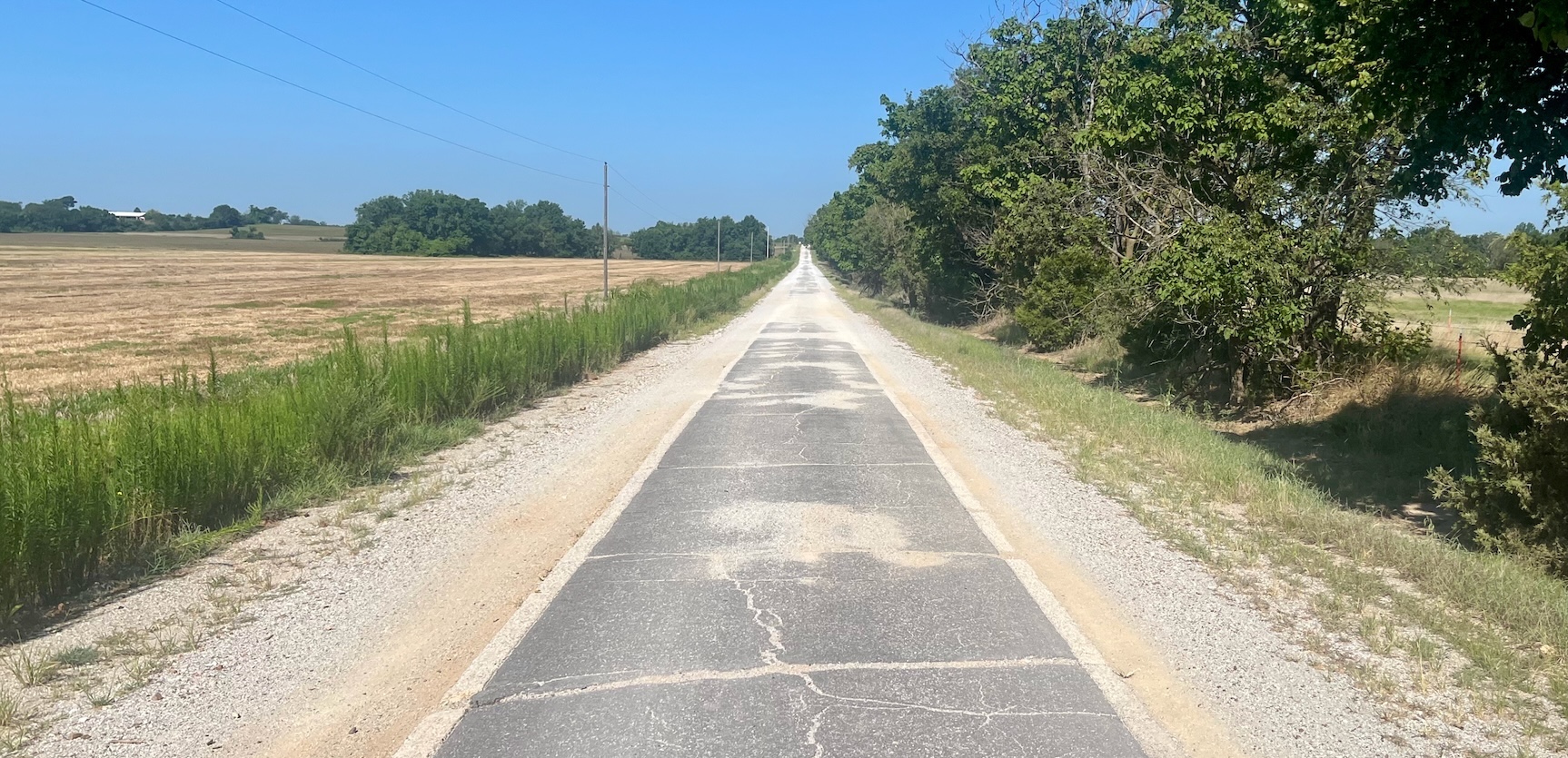
The GPS route had me turn off the main road one cross street before the Ribbon Road intersection, and creep up a dirt road to approach it from a different angle. This 13 mile stretch is broken up by six right angle turns, and I had arrived at the southernmost one. My heart sank. Orange barrels lined the eastern edge of the long straightaway ahead to the northern horizon. There weren’t any active road crews working on it, heck, there wasn’t even another person that I could see or hear in any direction. But it was covered in the debris of road resurfacing, all but impossible to skateboard, and maybe not even the original pavement anymore. To the west was the final mile of the Ribbon Road back to the active Route 66, not under construction but looking about as rough as you would expect hundred year old asphalt to be.
This is called the Sidewalk Highway in addition to Ribbon Road because it’s only nine feet wide. It turns out this road was paved before Route 66 existed (and later incorporated into it), during a statewide project to redo early roads that were hastily created at the turn of the century. The story goes that government funding was tight by the time it came to this segment between the towns of Miami and Afton, and rather than only do half of it with both lanes, they opted to complete the entire length with only one. There are white edges on both sides, like the white lines on modern highways, tiny concrete curbs bookending the asphalt surface, lending to the old timey feel. I had come this far and was facing a long drive back to Tulsa whether I ended up riding a skateboard or not, so I might as well.
Was it the smoothest ride ever? Of course not, it was closer to the roughest. Was it nice to use my legs and feel active after hours in the car? Sure, though it only lasted a couple minutes. Could I have planned better? Maybe. I did try searching public social media for combinations of “Catoosa” or “Oklahoma” and “abandoned turnpike” to see how recently someone had been out there. Nothing within the last few months that could have indicated it was no longer available to explore. Sitting here now I still can’t find anything about what’s going on there now. But I’m not sure it would have been better to know before booking the trip that the abandoned turnpike was gone. When skateboards were prohibited at Shark Valley, I rented a bike and ended up seeing an alligator. When the Lincoln Highway was closed, I ended up trying a Runza nearby. Taking an extra 140 mile round trip for what ended up being not even one mile of skateboard activity brought me to not only this little piece of history, but some other classic Route 66 kitsch that wasn’t on my original list of things to see. And I made a serious dent in my podcast backlog.