Banks–Vernonia State Trail
Aug 25, 2017 • 23.6 miles
Sometime last night, the house dog of this Airbnb lost all control of its bowels — on both floors. I woke up early to screaming and opened my door a crack. I could see across the hall, into the bathroom, an artful splatter up and down the shower walls. So while everyone else flailed in disgusted panic, I hastily got dressed, threw my toothbrush and some granola bars into my pack, and bolted.
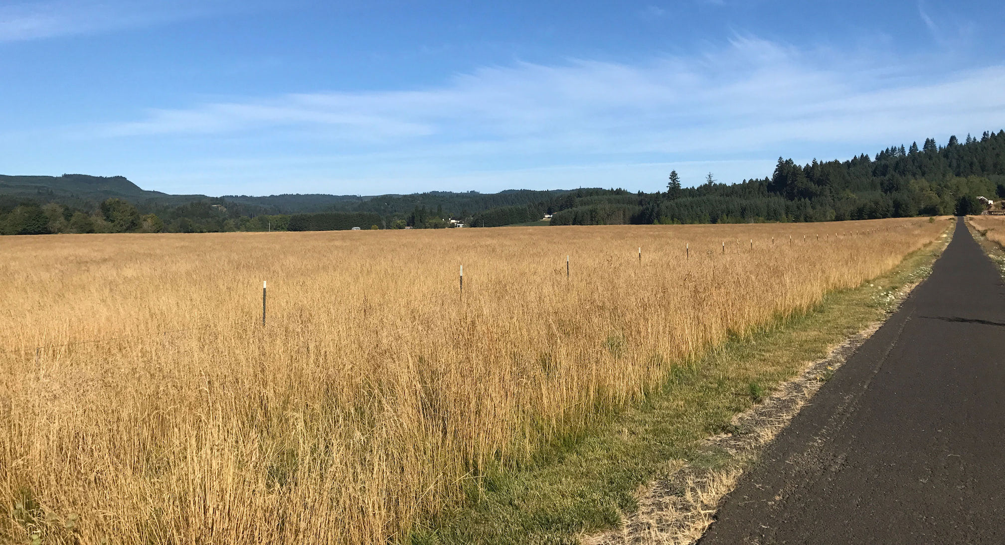
The trail is a good ways west of Portland, and the long Lyft drive gave me many opportunities to wonder at the countryside and spark conversation with the driver. For the former, gently rolling farmland bordered by mountains at the horizons; for the latter, agreement that the new Taylor Swift song is “pretty pretty bad.” She dropped me off at the southern trailhead in Banks and headed back to the city. I took advantage of the facilities to brush my teeth and fill my water pack before setting off.
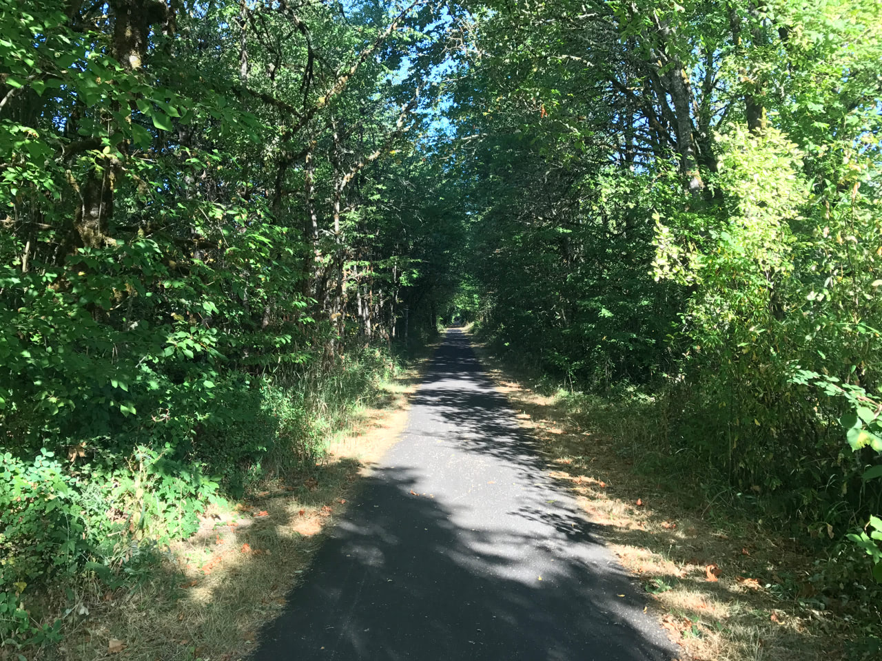
This is Oregon’s first rails-to-trail, uh, trail, handed over to the state parks department in 1990. For the first mile or so north out of Banks, a sibling railroad track runs parallel. Other than that, there’s relatively little to observe, especially compared to the Willamette River Loop that’s always passing through towns and cities. Here, instead, it’s either a paved trail through forest, branches drooping over you and making the occasional crude arch, or paved trail through open farmland. It’s very quiet too. I almost felt guilty at how much noise my rattling skateboard was creating.
The majority of the first half was at a very slight uphill, enough to make me question whether I was still tired from two days ago. The asphalt was smooth in places and coarse in others, though needles dropped from the trees had been kind of worn into the cracks by constant cycling, smoothing out the coarse bits. It never felt overwhelming, and nevertheless I stopped at the optimistically-named Tophill trailhead for a breather. I also took the chance to tighten the hardware on my board in the hopes it would reduce the rattling. It didn’t, but I sure felt like a real handyman for a minute.
 Most of the other people I saw were on their bicycles, either zooming past me in the other direction or passing me from behind. One of the few joggers I passed was out with her dog, who became very scared upon my approach. “A skateboard is the only thing he hasn’t seen on this trail!” Score another bewilderment point for me.
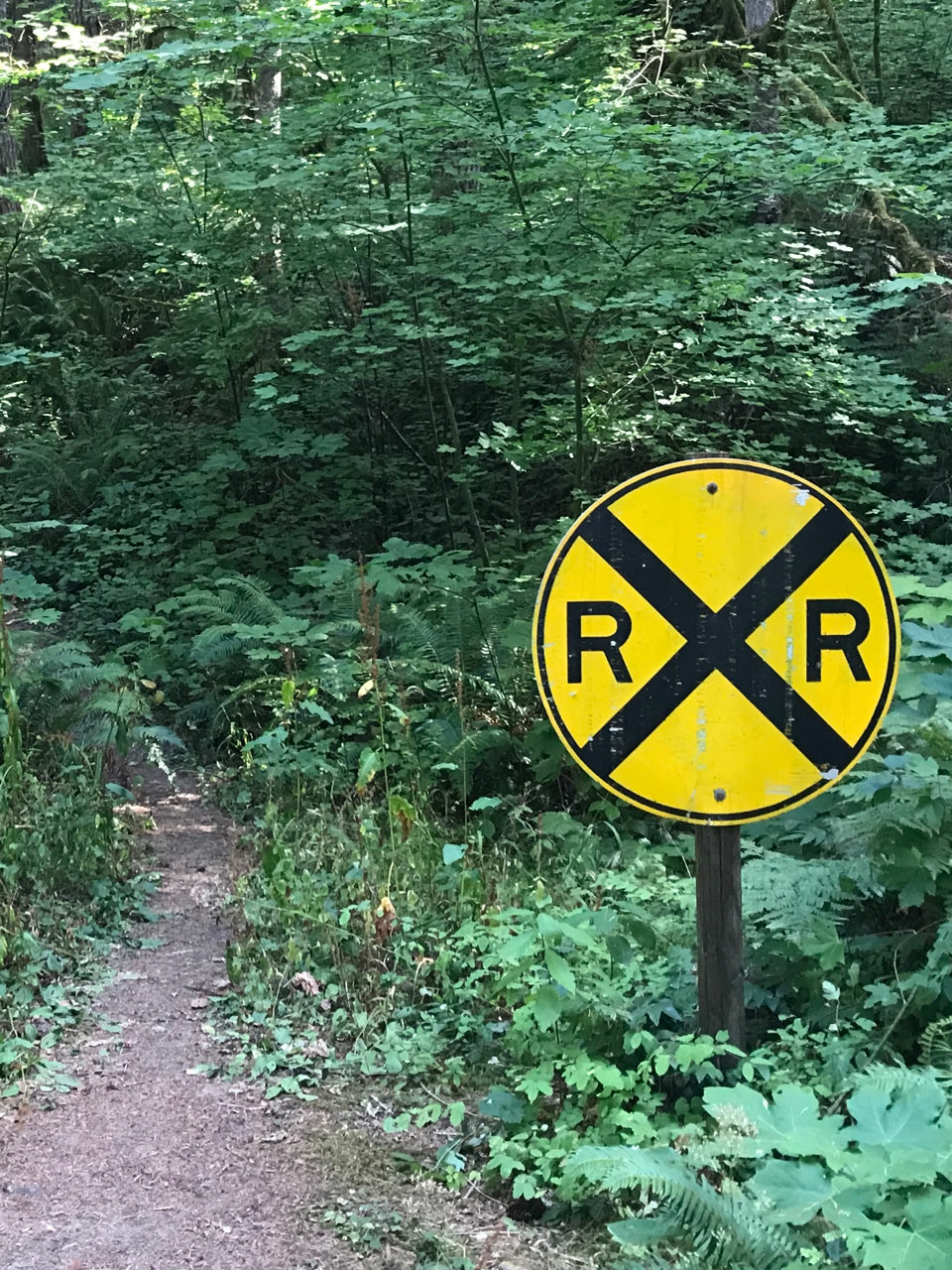
After the initial few miles of parallel active railroad track, there wasn’t much indication that the trail itself used to be a railway. The few reminders that survived were particularly noteable. One was a nice, long trestle bridge elevated way above the valley. Its floor surface was new pavement, obviously, but the sides looked like the original wood. And then a random railroad crossing sign, far away from any road. Maybe put in after the fact, as a joke.
At around the halfway point of the trail, a series of severe switchbacks brought me down to a road crossing and back up from it. I had to walk both of these, again for fear of faceplanting and getting tired, respectively. And then it was smooth sailing the rest of the way, likely from a similarly subtle downhill. Judging from distance markers, I was able to coast over one and a half miles without having to kick for more speed or drag a foot to slow down. It was the dessert after dinner, paycheck after work, reaping what I’d sowed.
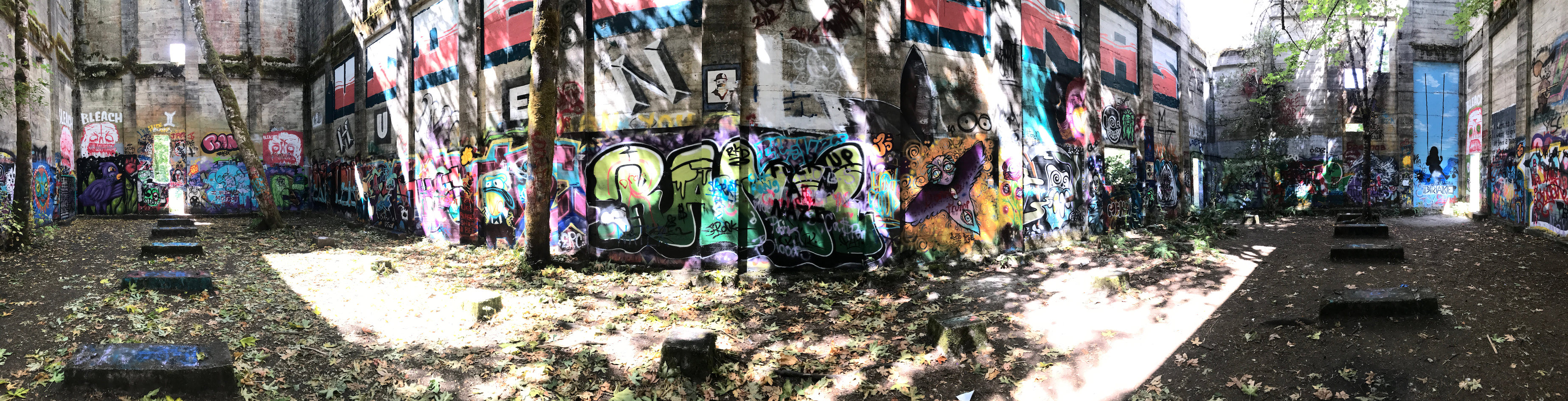
The trail ends after some 21 miles in Vernonia, with a quick little loop around Vernonia Lake. As would be later confirmed by a local, Vernonia Lake is more of a pond, or even a puddle. It’s the spot where the Oregon-American Lumber Company set up shop, as little placards around the perimeter will tell you. But for the ultimate end to my day, I hopped off the loop and explored the abandoned saw mill. A huge structure reduced to its four walls: completely gutted on the inside with only a tiny section of roof remaining. Full-grown trees have taken root inside and are now sprouting out the top. And Oregon’s finest street artists have decorated all throughout the interior. It feels like a house of worship, for some religion crossed between nature devotees and rebellious taggers. Stepping inside, no joke, took my breath away.